 |
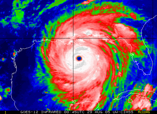
| This is a map of hurricane Katrina in the Gulf of Mexico, as seen from an infrared satellite. Infrared satellite senses temperatures at surface level and temperatures of cloud tops. The colder cloud tops are returned as lighter colors. This signals higher, thicker, more intense cloud tops. As the clouds warm and become thinner, the reflectivity fades from the bright whites, to red and green as seen form this image. Infrared radar can have many different color schemes, this is just one. http://saams.com/Katrina/Katrina.htm |
Sunday, November 14, 2010
Infrared satellite imagery of Hurricane Katrina
Subscribe to:
Post Comments (Atom)
No comments:
Post a Comment